


Vous pensez qu'il y a une erreur sur ce lieu ?
Signaler une erreur
Vos retours sont importants pour nous. Si vous avez remarqué une erreur concernant ce lieu, merci de nous en informer pour que nous puissions la corriger.
Propriétaire de ce lieu ?
Nous récupérons automatiquement les informations disponibles sur votre lieu. Si jamais celles-ci ne sont pas correctes, connectez-vous gratuitement sur notre tableau de bord pour les modifier et bonus, accédez à vos statistiques détaillées.
Ce qu'en disent les utilisateurs
Autres lieux à voir autour
 Pn du Mont Rainier-Ent. Nisqually
39000 State Route 706 E, Longmire, WA 98397, États-Unis
Ajouté par179 utilisateurs
Pn du Mont Rainier-Ent. Nisqually
39000 State Route 706 E, Longmire, WA 98397, États-Unis
Ajouté par179 utilisateurs
 Aéroport international de Seattle-Tacoma
17801 International Blvd, Seattle, WA 98158, États-Unis
Ajouté par174 utilisateurs
Aéroport international de Seattle-Tacoma
17801 International Blvd, Seattle, WA 98158, États-Unis
Ajouté par174 utilisateurs
 Parc national du Mont Rainier
Washington, États-Unis
Ajouté par170 utilisateurs
Parc national du Mont Rainier
Washington, États-Unis
Ajouté par170 utilisateurs
 Snoqualmie Falls
PO 1093, Snoqualmie, WA 98065, États-Unis
Ajouté par164 utilisateurs
Snoqualmie Falls
PO 1093, Snoqualmie, WA 98065, États-Unis
Ajouté par164 utilisateurs
 Multnomah Falls
, Oregon, États-Unis
Ajouté par148 utilisateurs
53000 Historic Columbia River Hwy
53000 Historic Columbia River Hwy, Corbett, OR 97019, USA
Ajouté par132 utilisateurs
Multnomah Falls
Multnomah Falls, Oregon, États-Unis
Ajouté par148 utilisateurs
53000 Historic Columbia River Hwy
53000 Historic Columbia River Hwy, Corbett, OR 97019, USA
Ajouté par132 utilisateurs
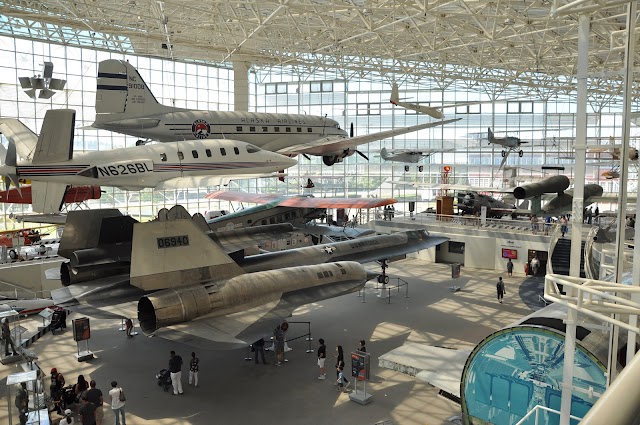 The Museum of Flight
9404 E Marginal Way S, Seattle, WA 98108, États-Unis
Ajouté par114 utilisateurs
The Museum of Flight
9404 E Marginal Way S, Seattle, WA 98108, États-Unis
Ajouté par114 utilisateurs
 Columbia River Gorge National Scenic Area
Cascade Locks, OR 97014, États-Unis
Ajouté par86 utilisateurs
Columbia River Gorge National Scenic Area
Cascade Locks, OR 97014, États-Unis
Ajouté par86 utilisateurs
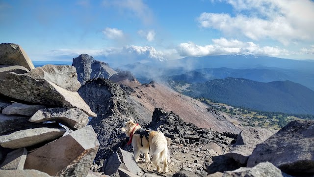
 Mont Rainier
, Washington 98304, États-Unis
Ajouté par68 utilisateurs
Mont Rainier
Mont Rainier, Washington 98304, États-Unis
Ajouté par68 utilisateurs
 Twede's Cafe
137 W North Bend Way, North Bend, WA 98045, États-Unis
Ajouté par69 utilisateurs
Twede's Cafe
137 W North Bend Way, North Bend, WA 98045, États-Unis
Ajouté par69 utilisateurs
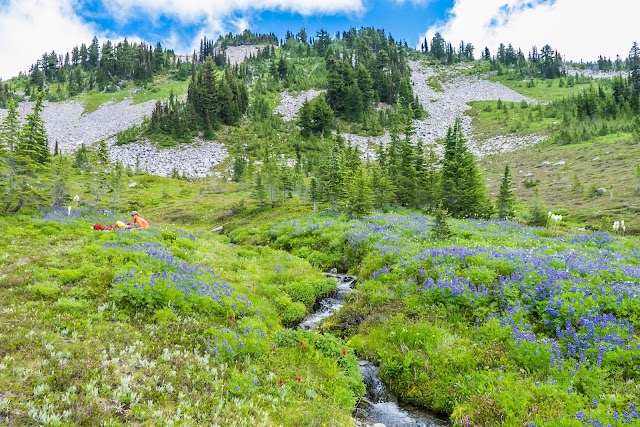
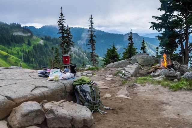
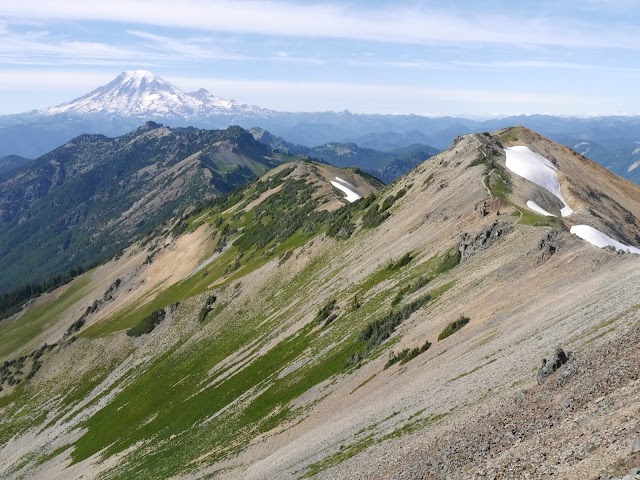
"The Goat Rocks Traverse begins at Snowgrass Flats, ascending through vibrant wildflower meadows. Hikers soon find themselves on the Pacific Crest Trail, winding along high ridgelines with expansive views of Mount Adams and Mount St. Helens. The route climbs steadily to the base of Old Snowy Mountain, where trekkers can opt for a short scramble to its 7,930-foot summit. Continuing along the Knife's Edge, hikers carefully navigate the narrow, exposed ridge, with steep drop-offs on both sides."
@sbsulliv2000
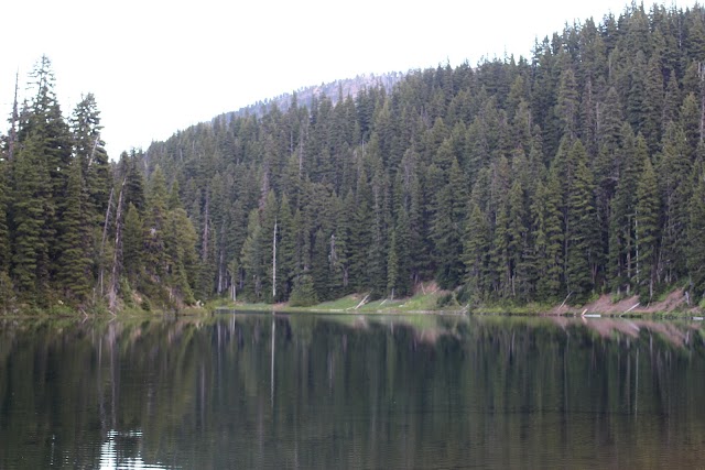
" The 108,023 acre Goat Rocks Wilderness is a part of the volcanic Cascade Mountain Range in southwestern Washington located between Mt. Rainier and Mt. Adams. The Goat Rocks are remnants of a large volcano, extinct for some two million years. A portion of Goat Rocks Wilderness is within the Okanogan-Wenatchee National Forest. Glaciation and erosion have worn away at the terrain here, leaving moderate summits on both sides of the crest of the Cascades. The elevation in the Goat Rocks ranges from 3,000 feet to 8,201 feet at Gilbert Peak. The deep east-west drainages below the ridges often open into park-like alpine meadows dotted with small lakes and even smaller ponds. Annual snowfall typically equals more than 25 feet, not melting entirely until late July or early August and keeping the ponds and lakes full in the warmer months. Pikas and marmots inhabit areas above timberline, while the more reserved deer and elk have been sighted at lower elevations. Mountain goats frequent the higher elevations. Much of the 120-mile trail system stays on the ridges at or above timberline. The Pacific Crest National Scenic Trail #2000 (PCT) wanders north-south through the middle of the Wilderness for 31.1 miles, past 7,930-foot Old Snowy Mountain, where glaciers persist. Approximately 14 other trails climb to eventually join the Pacific Crest Trail."
@
"Recommended by nurse Linnaea"
@