


Munising Falls Visitor Center
Vous pensez qu'il y a une erreur sur ce lieu ?
Signaler une erreur
Vos retours sont importants pour nous. Si vous avez remarqué une erreur concernant ce lieu, merci de nous en informer pour que nous puissions la corriger.
Propriétaire de ce lieu ?
Nous récupérons automatiquement les informations disponibles sur votre lieu. Si jamais celles-ci ne sont pas correctes, connectez-vous gratuitement sur notre tableau de bord pour les modifier et bonus, accédez à vos statistiques détaillées.
Ce qu'en disent les utilisateurs
Autres lieux à voir autour
 Pictured Rocks National Lakeshore
Munising, Michigan 49862, États-Unis
Ajouté par68 utilisateurs
Pictured Rocks National Lakeshore
Munising, Michigan 49862, États-Unis
Ajouté par68 utilisateurs
 Tahquamenon Falls State Park
41382 M-123, Paradise, MI 49768, États-Unis
Ajouté par62 utilisateurs
Tahquamenon Falls State Park
41382 M-123, Paradise, MI 49768, États-Unis
Ajouté par62 utilisateurs
 Al Johnson's Swedish Restaurant & Butik
10698 N Bay Shore Dr, Sister Bay, WI 54234, USA
Ajouté par41 utilisateurs
Al Johnson's Swedish Restaurant & Butik
10698 N Bay Shore Dr, Sister Bay, WI 54234, USA
Ajouté par41 utilisateurs
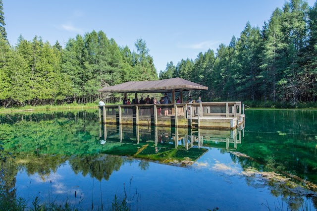 Kitch-iti-kipi
Sawmill Rd, Manistique, MI 49854, USA
Ajouté par28 utilisateurs
Kitch-iti-kipi
Sawmill Rd, Manistique, MI 49854, USA
Ajouté par28 utilisateurs
 Presque Isle Park
Peter White Dr, Marquette, MI 49855, USA
Ajouté par27 utilisateurs
Presque Isle Park
Peter White Dr, Marquette, MI 49855, USA
Ajouté par27 utilisateurs
 Legs Inn
6425 N Lake Shore Dr, Harbor Springs, MI 49740, États-Unis
Ajouté par26 utilisateurs
Legs Inn
6425 N Lake Shore Dr, Harbor Springs, MI 49740, États-Unis
Ajouté par26 utilisateurs
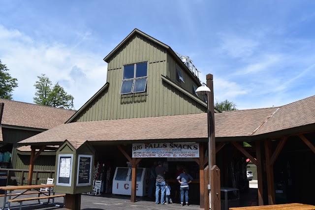
 Palms Book State Park
Thompson, Manistique, MI 49854, États-Unis
Ajouté par22 utilisateurs
Palms Book State Park
Thompson, Manistique, MI 49854, États-Unis
Ajouté par22 utilisateurs
 Whitefish Point Lighthouse
18335 N Whitefish Point Rd, Paradise, MI 49768, USA
Ajouté par15 utilisateurs
Whitefish Point Lighthouse
18335 N Whitefish Point Rd, Paradise, MI 49768, USA
Ajouté par15 utilisateurs
 Iron Bay Restaurant
105 E Washington St., Marquette MI 49855
Ajouté par14 utilisateurs
Iron Bay Restaurant
105 E Washington St., Marquette MI 49855
Ajouté par14 utilisateurs
 Fayette Historic State Park
4785 II Rd, Garden, MI 49835, USA
Ajouté par14 utilisateurs
Fayette Historic State Park
4785 II Rd, Garden, MI 49835, USA
Ajouté par14 utilisateurs
"Pretty view and beach to swim Chapel loop trail"
@
"Alger County, Michigan, United States"
@interesting
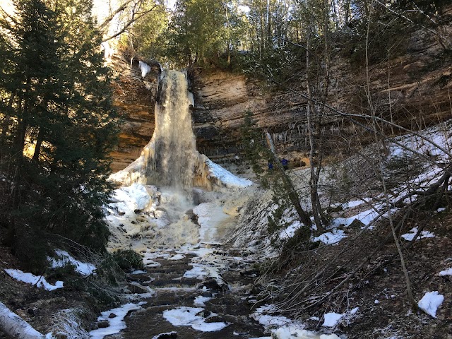
"Minerals? In rocks? Groundbreaking. Michigan’s Upper Peninsula attracts visitors with its wild, lush, and practically untouched forests and beachfront views, and also with its actual groundbreaking wonders. One of Michigan’s most memorable spaces are the northern cliffs of this peninsula, made of 500-million-year-old material. The cliffs look ancient, weathered and streaked with color from iron, manganese, limonite, and copper. They rise up to 200 feet above the deepest turquoise water and stretch for 15 miles. Once visitors have looked their fill at this geological wonder, there’s also biking, hiking, fishing, and beaches to enjoy. Pictured Rocks was the first of the three designated national lakeshores in the U.S. The 42-mile-long stretch of Lake Superior falls in Michigan’s Upper Peninsula and comprises 10 inland lakes, nearly 100 miles of hiking trails, and 15 miles of colorful sandstone cliffs that give the lakeshore its name. Every season brings new reasons to visit Pictured Rocks: In the summer, visitors are encouraged to camp or view the cliffs from a boat tour (permits and reservations required; leaf peepers flock to the region in the fall; and those willing to brave the freezing temperatures and unpredictable weather will be rewarded with picturesque frozen waterfalls in the winter and birding opportunities in the spring. Pictured Rocks National Lakeshore is home to a circa-1870s light station on Au Sable Point. Continually staffed until the Coast Guard left in 1958, the lighthouse became fully automated in 1958 and today is operated by a small solar-powered light. Be prepared for a 1.5-mile walk (one way) to the lighthouse from the parking lot through a campground; don’t miss the exposed shipwreck remains on the beach below. Pets are permitted on the access road, but bicycles are not."
@
"https://www.facebook.com/100047223343396/posts/163553325228778/?d=n"
@
"Chapel trail mosquito falls "
@
"With many bodies of water in the US being a murky brown, the blue-green water of Lake Superior doesn't exactly fit in. The Pictured Rocks stretch for nearly 15 miles along the lake and tower above it anywhere from 50 to 200 feet, letting the vibrant Great Lake glimmer in its beauty. "
@