


Salt Creek Falls
Vous pensez qu'il y a une erreur sur ce lieu ?
Signaler une erreur
Vos retours sont importants pour nous. Si vous avez remarqué une erreur concernant ce lieu, merci de nous en informer pour que nous puissions la corriger.
Propriétaire de ce lieu ?
Nous récupérons automatiquement les informations disponibles sur votre lieu. Si jamais celles-ci ne sont pas correctes, connectez-vous gratuitement sur notre tableau de bord pour les modifier et bonus, accédez à vos statistiques détaillées.
Ce qu'en disent les utilisateurs
Autres lieux à voir autour
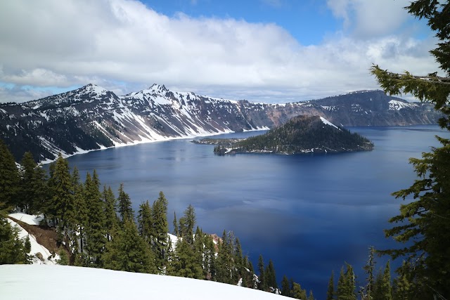 Crater Lake National Park
Oregon, États-Unis
Ajouté par288 utilisateurs
Crater Lake National Park
Oregon, États-Unis
Ajouté par288 utilisateurs
 Smith Rock State Park
, Terrebonne, OR 97760, États-Unis
Ajouté par130 utilisateurs
Smith Rock State Park
Smith Rock State Park, Terrebonne, OR 97760, États-Unis
Ajouté par130 utilisateurs
 Toketee Falls
OR-138, Clearwater, OR 97447, États-Unis
Ajouté par126 utilisateurs
Toketee Falls
OR-138, Clearwater, OR 97447, États-Unis
Ajouté par126 utilisateurs
 Lightning Springs Camp
Lightning Spring Trail, Chiloquin, OR 97624, États-Unis
Ajouté par101 utilisateurs
Lightning Springs Camp
Lightning Spring Trail, Chiloquin, OR 97624, États-Unis
Ajouté par101 utilisateurs
 Crater Lake
, Oregon 97604, États-Unis
Ajouté par101 utilisateurs
Crater Lake
Crater Lake, Oregon 97604, États-Unis
Ajouté par101 utilisateurs
 Tamolitch (Blue) Pool
Comté de Linn, Oregon 97759, États-Unis
Ajouté par94 utilisateurs
Tamolitch (Blue) Pool
Comté de Linn, Oregon 97759, États-Unis
Ajouté par94 utilisateurs
 Umpqua Hot Springs
NF-3401, Idleyld Park, OR 97447, États-Unis
Ajouté par75 utilisateurs
Umpqua Hot Springs
NF-3401, Idleyld Park, OR 97447, États-Unis
Ajouté par75 utilisateurs
 Spork
937 NW Newport Ave, Bend, OR 97701, États-Unis
Ajouté par56 utilisateurs
Spork
937 NW Newport Ave, Bend, OR 97701, États-Unis
Ajouté par56 utilisateurs
 Crux Fermentation Project
50 SW Division St, Bend, OR 97702, États-Unis
Ajouté par56 utilisateurs
Crux Fermentation Project
50 SW Division St, Bend, OR 97702, États-Unis
Ajouté par56 utilisateurs
 Deschutes Brewery Bend Public House
1044 NW Bond St, Bend, OR 97703, États-Unis
Ajouté par53 utilisateurs
Deschutes Brewery Bend Public House
1044 NW Bond St, Bend, OR 97703, États-Unis
Ajouté par53 utilisateurs
"In the winter, the gates are locked, and you must walk in to visit the falls. Prep with good footwear and a warm coat. The mist from the falls can coat surfaces in ice. A day area the shares the turn off provides a steep sledding hill. Bathrooms are at both the falls and the day area, though the falls’ bathrooms are closed in the winter. In the summer, Salt Creek Falls is a wonderful area to hike, picnic on their benches, and stretch legs if traveling over the Willamette Pass on Hwy 58. Two hikes start at the parking lot, a 3.4-mile loop, and a 6-mile loop."
@sbsulliv2000
"https://www.alltrails.com/trail/us/oregon/salt-creek-falls-trail https://www.alltrails.com/trail/us/oregon/diamond-creek-falls-trail--2"
@bbirdbrown
"See pocket Flipboard article "
@
"Nearby clothing optional McCredie hot springs"
@
"Salt Creek Falls Trail #3673 At 286 feet, Salt Creek Falls is the second highest waterfall in Oregon and a popular stop for Hwy 58 travelers. After viewing the interpretive exhibits at the Salt Creek Falls Observation Site, the viewing platform is approximately 50 yards down the trail. To the right of the viewing platform, a more difficult spur trail takes off. The pavement ends at the top of the stairway, where the trail drops steeply into the canyon, ending near the base of this magnificent waterfall. To the left of the viewing platform, the trail continues to loop around offering a short hike back to the parking lot (50 yards) or a somewhat longer hike (250 yards) following the Salt Creek through the picnic area. For a longer hike, take the bridge from the picnic area across Salt Creek to the Diamond Creek Falls Loop Trail. This 3.2 mile (5.1499 km) loop trail skirts the rims of the Salt Creek and Diamond Creek Canyons."
@