


Mount Tamalpais State Park
Vous pensez qu'il y a une erreur sur ce lieu ?
Signaler une erreur
Vos retours sont importants pour nous. Si vous avez remarqué une erreur concernant ce lieu, merci de nous en informer pour que nous puissions la corriger.
Propriétaire de ce lieu ?
Nous récupérons automatiquement les informations disponibles sur votre lieu. Si jamais celles-ci ne sont pas correctes, connectez-vous gratuitement sur notre tableau de bord pour les modifier et bonus, accédez à vos statistiques détaillées.
Ce qu'en disent les utilisateurs
Autres lieux à voir autour
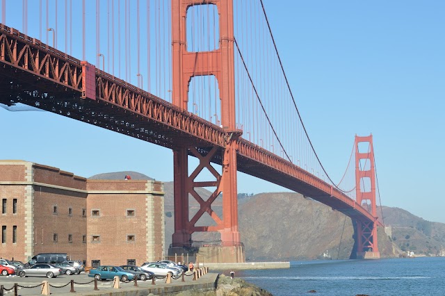
 Golden Gate Bridge
, California, États-Unis
Ajouté par2321 utilisateurs
Golden Gate Bridge
Golden Gate Bridge, California, États-Unis
Ajouté par2321 utilisateurs
 Muir Woods National Monument
1 Muir Woods Rd, Mill Valley, CA 94941, États-Unis
Ajouté par521 utilisateurs
Muir Woods National Monument
1 Muir Woods Rd, Mill Valley, CA 94941, États-Unis
Ajouté par521 utilisateurs
 Bar Bocce
1250 Bridgeway, Sausalito, CA 94965, États-Unis
Ajouté par398 utilisateurs
Bar Bocce
1250 Bridgeway, Sausalito, CA 94965, États-Unis
Ajouté par398 utilisateurs
 Fish Restaurant
350 Harbor Dr, Sausalito, CA 94965, États-Unis
Ajouté par260 utilisateurs
Fish Restaurant
350 Harbor Dr, Sausalito, CA 94965, États-Unis
Ajouté par260 utilisateurs
 Sutro Baths
680 Point Lobos Ave, San Francisco, CA 94121, États-Unis
Ajouté par354 utilisateurs
Sutro Baths
680 Point Lobos Ave, San Francisco, CA 94121, États-Unis
Ajouté par354 utilisateurs
 Battery Spencer
Conzelman Rd, Sausalito, CA 94965, États-Unis
Ajouté par358 utilisateurs
Battery Spencer
Conzelman Rd, Sausalito, CA 94965, États-Unis
Ajouté par358 utilisateurs
 Fort Point
Marine Dr, San Francisco, CA 94129, États-Unis
Ajouté par280 utilisateurs
Fort Point
Marine Dr, San Francisco, CA 94129, États-Unis
Ajouté par280 utilisateurs
 Crissy Field
1199 E Beach, San Francisco, CA 94129, États-Unis
Ajouté par273 utilisateurs
Crissy Field
1199 E Beach, San Francisco, CA 94129, États-Unis
Ajouté par273 utilisateurs
 Lands End
680 Point Lobos Ave, San Francisco, CA 94121, États-Unis
Ajouté par270 utilisateurs
Lands End
680 Point Lobos Ave, San Francisco, CA 94121, États-Unis
Ajouté par270 utilisateurs
 Le Garage
85 Liberty Ship Way #109, Sausalito, CA 94965, États-Unis
Ajouté par129 utilisateurs
Le Garage
85 Liberty Ship Way #109, Sausalito, CA 94965, États-Unis
Ajouté par129 utilisateurs
"https://www.tiktok.com/t/ZP8h1SV6m/"
@
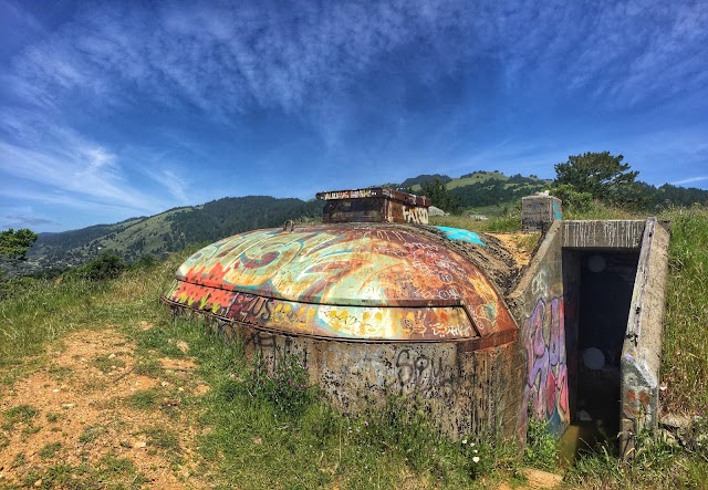
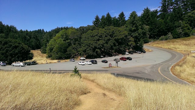
"Il Mt Tamalpais (Mt Tam) si erge maestoso a guardia della Marin County e racchiude oltre 200 miglia (322 km) di sentieri da esplorare a piedi o in bicicletta, laghi, ruscelli, cascate e una grande varietà di fauna selvatica – da tritoni e falchi a rare volpi e leoni di montagna. Fatevi strada tra prati, querce e piante arbustive per ammirare panorami mozzafiato sulla San Francisco Bay, l’Oceano Pacifico, le cittadine e le colline boscose che si estendono in lontananza. La zona intorno a questa tranquilla montagna alta 784 m comprendente il Mt Tamalpais State Park (cartina p452; %415-3882070; www .parks .ca .gov/mttamalpais; $8 per automobile; h7-tramonto; p) S, il Marin Municipal Water District, il Muir Woods National Monument, diverse aree all’aperto della Marin County e la Golden Gate Recreation Area, ed è un vero e proprio paradiso per l’escursionismo. Potete scaricare una cartina dei sentieri e trovare suggerimenti utili per le vostre passeggiate sul sito web di OneTam (www.onetam.org). Una delle escursioni più belle sulla montagna è quella che segue lo Steep Ravine Trail. Dalla sede del parco presso la Pantoll Station (cartina p452; %415-388-2070; www .parks . ca .gov; 801 Panoramic Hwy; horario variabile; W), il sentiero costeggia un torrente immerso nei boschi fino a raggiungere la costa, a circa 2,1 miglia (3,4 km) di distanza. "
@
"Fortunately, Mt. Tamalpais is easier to appreciate than it is to pronounce. Just North of the Golden Gate Bridge, Mt. Tamalpais State Park is a tiny slice of Redwood heaven regularly visited by San Francisco natives. On a clear day, you can hike to the top of Mt. Tamalpais, a 6-mile trek, to take in the sweeping views of Marin County hills, San Francisco, and Mount Diablo. If you’d rather not strap on your hiking boots, at the heart of the park is the 588-acre Muir Woods National Monument, one of the last-standing old-growth coastal redwood forests in the San Francisco Bay area. There, you’ll find subtle walking paths through lush Redwood Groves and Tree Talks with rangers."
@
"San Francisco suburbs... 30 minutes from the city, you can still see the buildings and... WOW!!"
@